Salt air, sunrise over the Atlantic, and a quick stroll to the boardwalk are easy to picture. The details behind them are not. In Manasquan, a shift of one block can change your flood zone, insurance costs, and even what you can build. If you are thinking about a beach, lake, or river home, this guide gives you a clear view of location nuances, flood and insurance rules, smart due diligence, and long-term costs so you can buy with confidence. Let’s dive in.
Where “near the water” is in Manasquan
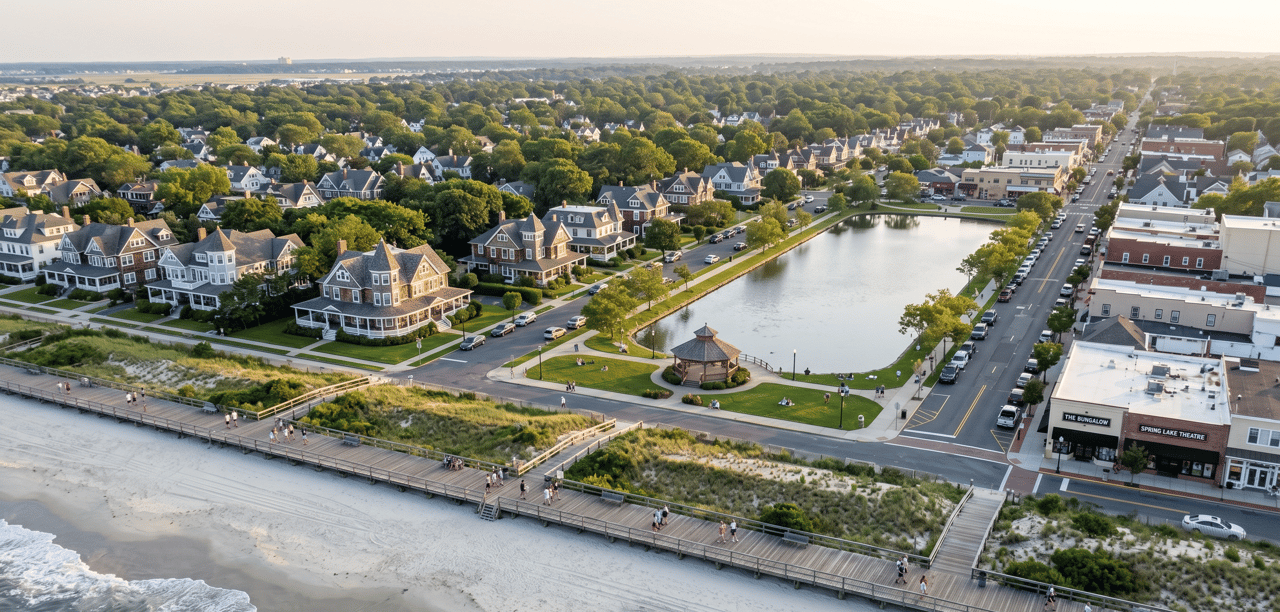
Oceanfront and boardwalk streets
First Avenue and the blocks bordering the boardwalk are the classic Manasquan beach pocket. You will often see homes described as “beachside of First Avenue” or “steps to the beach.” That short distance matters for views, wave exposure, flood designations, and price. Expect elevated foundations, salt-tolerant materials, and strong buyer demand for these addresses.
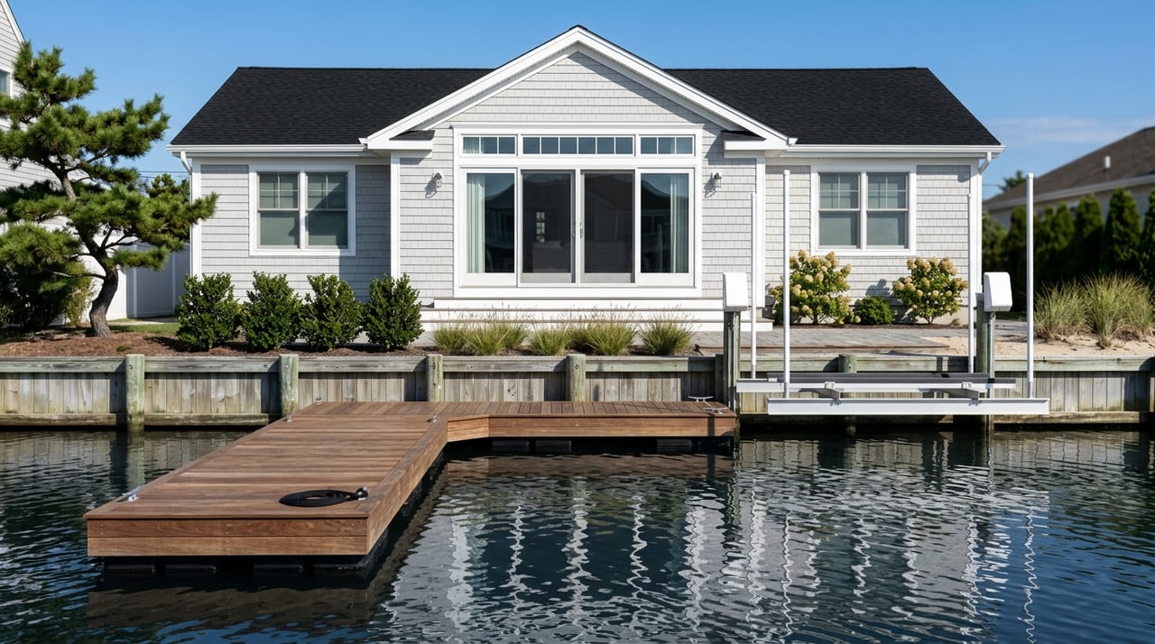
Stockton Lake homes
Stockton Lake Boulevard and nearby streets offer lake views, bulkheads, and private docks. Bulkhead condition is a regular inspection item and a future expense to plan for. The borough is working on Stockton Lake bulkhead and park improvements, a sign that shoreline upkeep is an ongoing, shared priority in this area. You can review the borough’s current project update on its page for Stockton Lake bulkhead and park improvements.
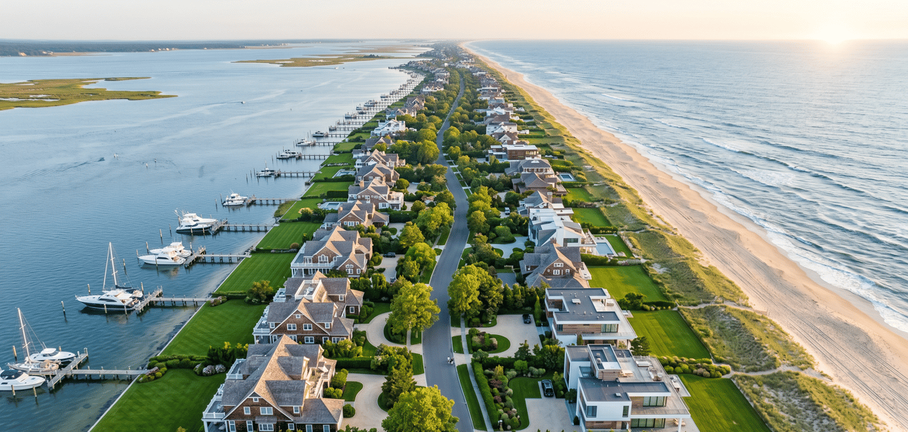
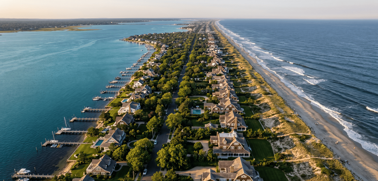
Manasquan River and inlet pockets
Homes along the Manasquan River bring wide-water views and boating access, with different dynamics from the ocean side. Near the inlet, confirm the exact jurisdiction. Inlet Drive and the Coast Guard station sit on the Point Pleasant Beach side, not within Manasquan. That difference affects taxes, permitting, and services. For inlet context and boundaries, the U.S. Coast Guard’s environmental assessment for Station Manasquan Inlet provides helpful detail on the area.
Micro-neighborhood differences
Two houses a few doors apart can face different surf exposure or wave action. Blocks near Brielle Road, Riddle Way, and the south end toward the inlet can experience different storm and sand movement patterns. In practice, one home may show a higher-risk coastal designation while the next street inland does not. Treat location as a street-by-street decision.
Flood, elevation, and insurance: how to check a property
How to verify a home’s flood status
Start with the Borough of Manasquan’s flood resources. The borough will search by address, tell you if a property sits in a Special Flood Hazard Area, and may have an elevation certificate on file. You can request these records early in your research using the borough’s Know Your Flood Hazard guidance.
Next, review FEMA flood maps and county GIS viewers for the base flood elevation, coastal wave lines, and any Limit of Moderate Wave Action near the lot. Together, these tools help you understand both current mapping and how that mapping drives building and insurance decisions.
Key terms that change cost
- Special Flood Hazard Area (SFHA). FEMA’s 1 percent annual chance flood zone. High-risk designations include AE and VE.
- VE vs. AE. VE areas face damaging wave action and stricter building standards. AE areas are high risk but usually have less wave energy.
- LiMWA. The Limit of Moderate Wave Action marks where 1.5-foot waves are expected during the base flood and can trigger VE-like building considerations just inland. For clear definitions, see the Region 2 Coastal glossary.
Insurance basics in coastal Manasquan
- NFIP availability and discounts. Manasquan participates in FEMA’s National Flood Insurance Program and the Community Rating System. The borough reports a CRS-based premium reduction for residents, which is applied directly to NFIP policies. Check the borough’s Flood Insurance page for current community status and discounts.
- Coverage limits and ICC. Standard NFIP building coverage for a single-family home tops out at $250,000. NFIP also includes Increased Cost of Compliance coverage up to $30,000 for qualifying substantially or repetitively damaged structures. You can review FEMA training guidance on ICC for details.
- Private or excess flood. Many high-value ocean, river, and lake homes exceed NFIP limits. In those cases, private flood or excess policies may be needed to bring coverage in line with potential rebuild costs.
Construction and renovation realities near the water
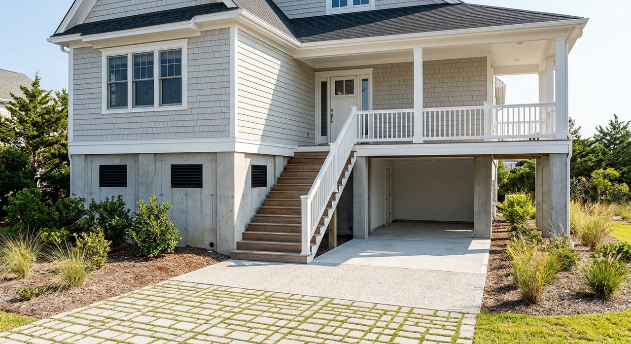
Elevation and coastal design
If a property sits in a VE or Coastal AE area, the first floor often must be elevated above the base flood elevation, with pile or engineered foundations. Ground levels are usually limited to parking and storage. These designs affect both renovation costs and how you use the space. Before planning updates, confirm whether past work triggered “substantial improvement” thresholds and what current rules apply. The borough’s Flood Damage Prevention ordinance outlines how local law adopts FEMA maps and sets elevation and compliance standards.
Bulkheads, docks, and permits
On Stockton Lake, the river, or near the inlet, bulkheads and docks are common and need periodic care. Replacement or repair can be significant, and permits can involve the borough, NJDEP, and sometimes the U.S. Army Corps. Ask who owns the bulkhead on the parcel, whether an engineering report exists, and if any public projects may change shoreline behavior. For a sense of active shoreline maintenance, see the borough’s page on Stockton Lake bulkhead improvements.
Long-range shoreline planning
County and local hazard planning look at sea-level scenarios and chronic tidal impacts on streets and infrastructure. These planning tools are non-regulatory, but they help you weigh long-term exposure. When you compare similar homes, a small elevation difference can be the tie-breaker for peace of mind and insurability.
Market snapshot and price context
As of a January 2026 snapshot, Realtor.com reported a median listing price around $1,449,000 in the Borough of Manasquan. Oceanfront and inlet-front properties often trade well above that median due to direct water exposure, elevation, and scarcity. Use current MLS data at offer time, and compare by exact street, flood zone, and construction type.
A buyer’s due-diligence checklist
Copy this list and use it during showings and attorney review. It will save you time and surprises.
- Flood zone and base flood elevation. Ask for the elevation certificate or request it from the borough. Note the flood zone, BFE, and any LiMWA or VE designation.
- Elevation certificate or map amendment. Confirm whether a Letter of Map Amendment or Revision exists for the structure.
- Insurance quotes early. Get NFIP and private-flood estimates and ask for the property’s prior NFIP loss history. Factor in any CRS discount the borough qualifies for.
- Bulkhead and dock status. Identify who owns the bulkhead, condition, last inspection, and permitting history. Budget for repair or replacement over time.
- Renovation history and “substantial improvement.” Ask for permits and verify whether any past work triggered full-code compliance.
- Utilities and services. Confirm public sewer vs. septic and water service line materials with the borough’s Water and Sewer office.
- Short-term rental rules. If you plan to rent seasonally, ask the borough clerk about registration, inspections, and any local caps.
- Jurisdiction check near the inlet. Confirm whether a desirable inlet address is in Manasquan or Point Pleasant Beach. Taxes, services, and permitting differ.
- Hurricane or wind deductibles. Many coastal homeowner policies carry a percentage-based hurricane or wind deductible. Understand triggers and out-of-pocket exposure.
Common pitfalls to avoid
- Assuming “no past flooding” means “no future risk.” Flood events can occur outside mapped high-risk zones. FloodSmart notes that many claims come from outside SFHAs.
- Underestimating coastal upkeep. Bulkheads, docks, and dunes require maintenance and sometimes major capital projects.
- Counting on a mortgage alone to set coverage. Lender-required flood insurance may not match the true rebuild cost of a high-value home. Private or excess coverage can close the gap.
- Skipping the municipality check at the inlet. Some inlet-facing spots fall in another town, which changes your approvals and costs.
Cost of ownership near the water
Plan your annual and long-term budgets with these line items in mind.
- Flood insurance. NFIP premiums vary by elevation and flood zone. Manasquan’s CRS participation can reduce NFIP costs for eligible policies. Ask your insurer to apply the discount if available.
- Homeowner’s insurance structure. Coastal policies may include wind or hurricane deductibles as a percent of dwelling coverage. Review New Jersey guidance so you know your trigger events and deductible math.
- Bulkhead and dock maintenance. Replace, repair, or reinforce on a planned cycle. Docks and lifts also need periodic service.
- Seasonal badges and parking. If you host guests or rent seasonally, factor in beach access logistics and seasonal costs.
- Storm prep and materials. Budget for shutters, sandbags, or other protective gear as part of your annual readiness plan.
How we help you buy near the water
You deserve clear guidance before you bid on a shoreline home. As a fourth-generation, boutique Jersey Shore brokerage, we bring neighborhood-by-neighborhood insight to oceanfront, inlet, lake, and river purchases. We help you compare streets and structures, understand flood and renovation implications, and weigh lifestyle and rental goals across seasons. If you would like a calm, confidential conversation about a Manasquan purchase, connect with Shawn Clayton.
Stockton Lake bulkhead and park improvements
U.S. Coast Guard Station Manasquan Inlet environmental assessment
Region 2 Coastal glossary of terms
Manasquan Flood Insurance and CRS information
Manasquan Flood Damage Prevention ordinance
Realtor.com Manasquan market snapshot
NJ hurricane deductible guidance
Ready to explore listings or get a second opinion on a property you love? Schedule a confidential consultation with Shawn Clayton.
FAQs
What flood zones are common near the Manasquan beach and inlet?
- You will see AE and VE designations along the oceanfront and near the inlet, with VE indicating higher wave action and stricter building standards. Ask for the elevation certificate and verify the base flood elevation for the exact structure.
How does Manasquan’s CRS discount affect my flood premium?
- Manasquan participates in FEMA’s Community Rating System, and the borough reports a premium reduction for NFIP policies. Confirm the current community class and discount with the borough and your insurer.
What should I look for on a lake or river property’s bulkhead?
- Ask who owns it, when it was last inspected, and whether permits or repairs are on record. Factor replacement timelines and costs into your long-term budget.
If my home’s value exceeds NFIP limits, what are my options?
- Many waterfront buyers pair an NFIP policy with private or excess flood coverage to match likely rebuild costs. Ask your insurance advisor to model several coverage tiers.
Does being outside the mapped SFHA mean I can skip flood insurance?
- Not necessarily. Flood events can happen outside high-risk zones. If the asset is valuable, many buyers still carry a low-cost preferred-risk or private policy to manage tail risk.
How do I confirm whether an inlet-area address is in Manasquan or a neighboring town?
- Check the tax records and municipal boundaries for the parcel. Some inlet-facing addresses are in Point Pleasant Beach, which changes taxes, permitting, and services.